blah blah blah
Russell Hill
Length: 1.8 miles out-and-backDifficulty (click for info): Beginner
Elevation Gain: 190 feet (+90 feet on return)
Rating (click for info): 4/10
Elevation: 738'
Prominence: 333'
Driving Directions:
Trailhead is on Russell Hill Road in Brookline, NH. From the junction of Rt. 13 and Rt. 130, turn west on Mason Road (opposite Rt. 130) and drive 1.8 miles, then turn left onto Russell Hill Road. Drive 1.2 miles to the height-of-land on the road, where there is a logging landing on the left. There is room to park at the entrance to the landing. Click here for a Google map.
About the Hike:
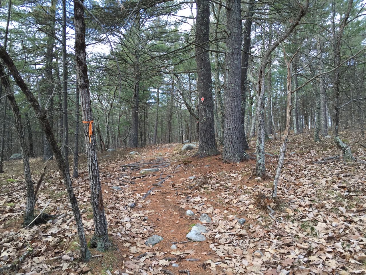
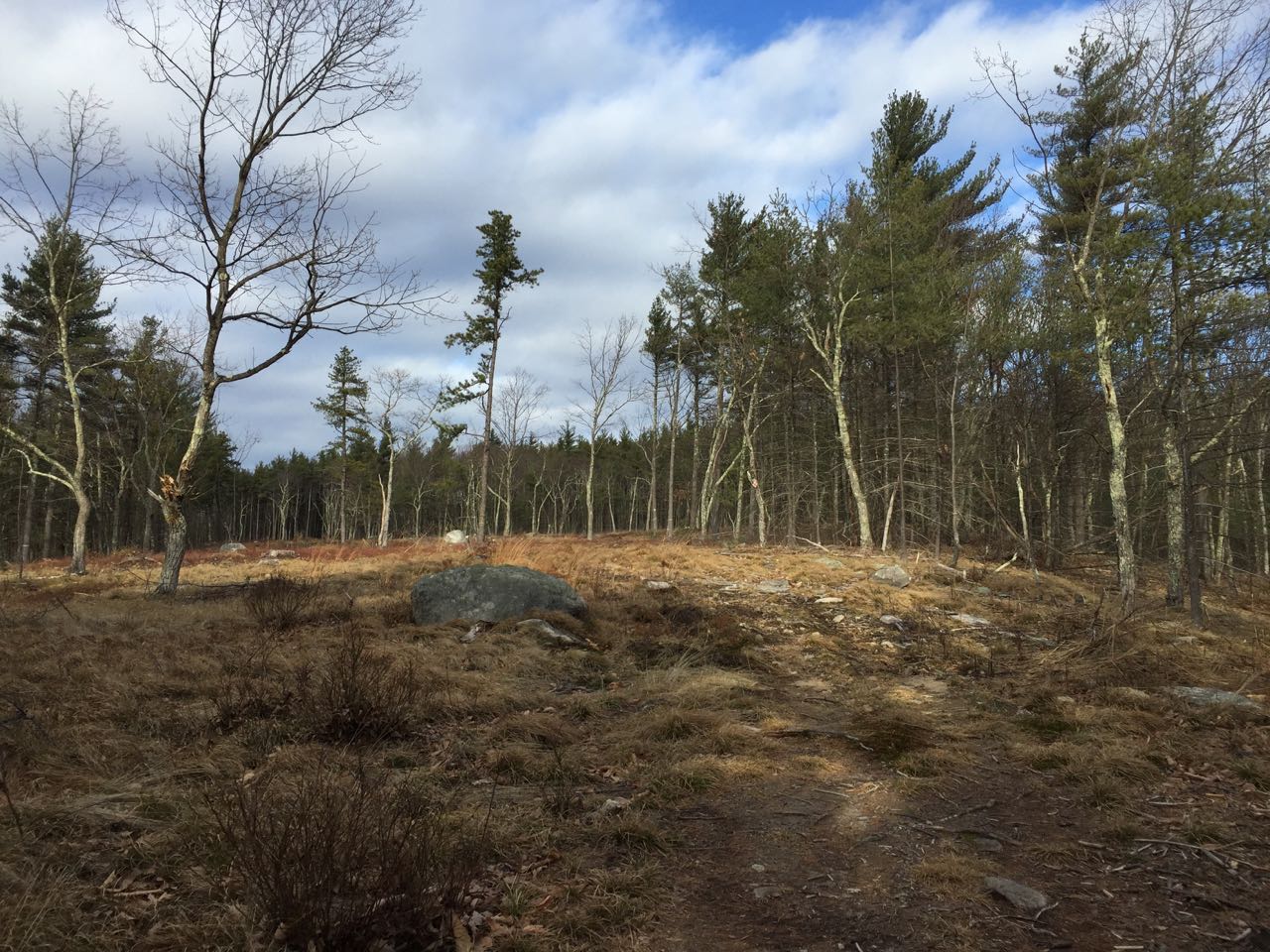
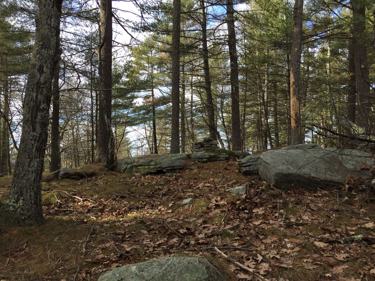
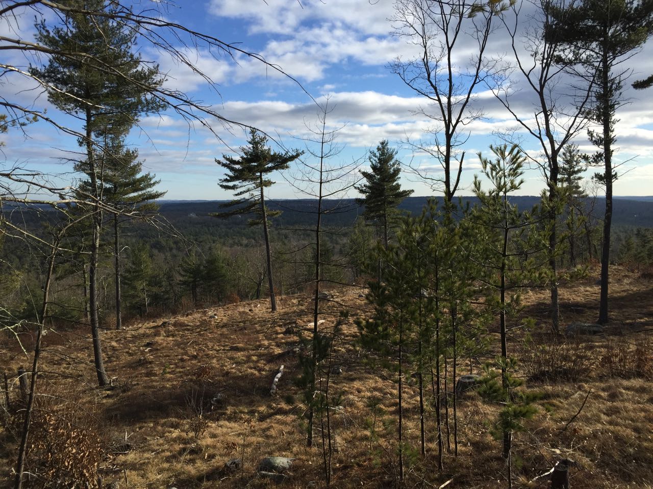
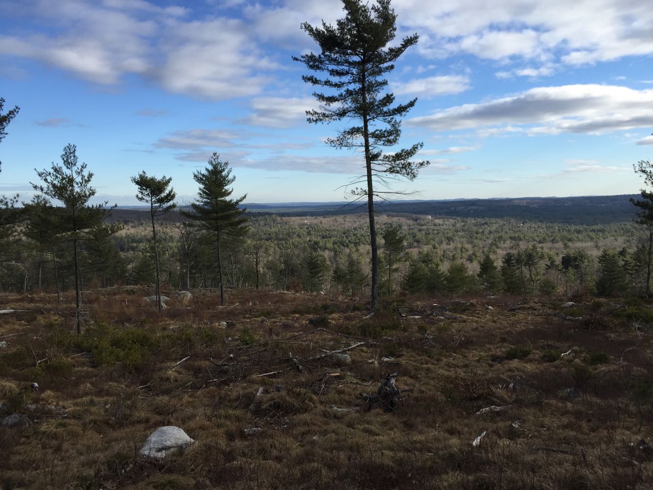
Russell Hill is a low hill in southwestern Brookline, near the Massachusetts border. The hill is a notable historical site for being associated with the Russell family, who settled the area in 1757 and lived there for nine consecutive generations. Today, the top of the hill has a stone monument that was used by the family as a lookout over Lake Potanipo and a flag post. It is also known to be a former fire tower site. Access to the summit is not well documented for hikers, but it can be reached on a comination of recent logging roads and a footpath marked with orange diamonds. Much of the eastern side of the hill has been logged over and now provides great views of the area.
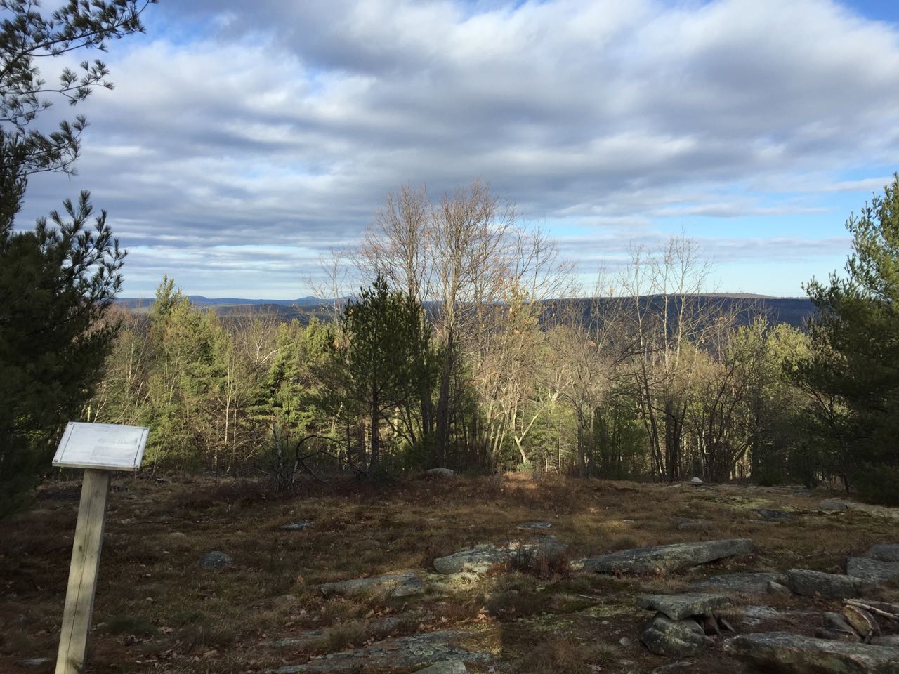
From Russell Hill Road, face the logging landing and look in the woods immediately on the right side of the clearing for a path leading from the road into the forest. This appears to be a skid road from the recent logging that may also be used by snowmobiles. It is preferable to visit at a dry time of year, as this road can easily flood. As you follow it, several other paths will diverge; stay left at every junction. In 0.15 miles, an alternate route coming from the back of the logging landing joins from the left. In another 0.15 miles, look for the orange diamonds and turn left onto the footpath. From here, the route is well-marked and easy to follow. It winds through the forest and soon enters a large clearing. It crosses the length of the clearing, where there are minor views. It continues into the woods and climbs easily to the wooded highpoint of the hill in 0.3 miles from the logging road. Continue to follow the trail for 0.1 miles beyond the summit as it leads across a flat area, crosses a wide, grassy snowmobile trail, and reaches the historical stone structure mentioned earlier, where there is an informational marker about the Russell family. There is a minimal view through the trees from here. For better views, head down the snowmobile trail to the right (east) side of where you came up. In 300 feet, look for the huge logged clearing on your right and cut across a small strip of forest on an obscure path to reach it. Explore the clearing for much better views of the extensive flat terrain to the south and east of the hill.
Printable directions page